
Feature
Map
Estimated positions from statuses and typical drive times, so you can see who is heading where. Not GPS.
The problem
A dispatcher needs situational awareness: who is heading where, what is loaded, which plants are waiting, and what looks wrong early. That should come from the statuses already on the board and a typical drive between the mill and the plant, not from a GPS box on every truck.
What it is not
Not live GPS, and not a tracker in the cab. The pin is an estimate. A GPS hookup is on the roadmap, and it is not in the board today.
How it works
- 1
Plants and mills keep a pin from the address you picked.
- 2
A truck with no load sits on its yard. A truck on a load sits at the mill, along the road, or at the plant, from the status that was marked and a typical drive time for that lane.
- 3
Loaded, empty, and waiting are the same day, drawn so a problem shows up before you read every row.
- 4
The spot moves when the status changes. It does not follow the truck down the highway.
- 5
Pop the map into its own window when the board and the map both need to stay open.
On the board
Demo Mix is a fictional company. The trucks are long-nose conventionals. Nothing on these screens is a real yard.
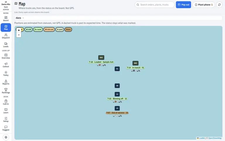
- 1. Truck from its status
- 2. Pop the map out
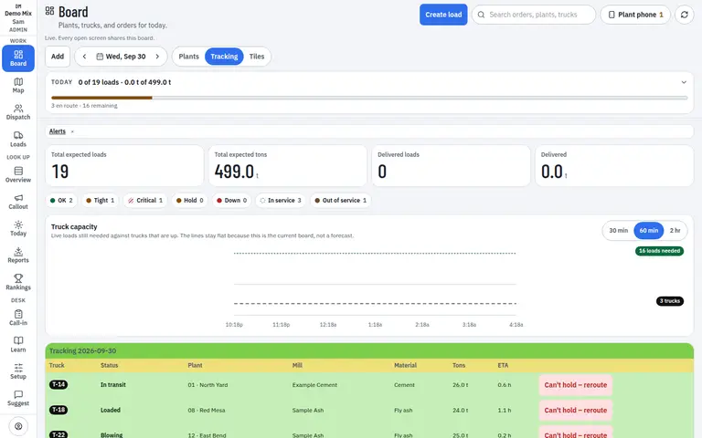
- 1. This status places the truck
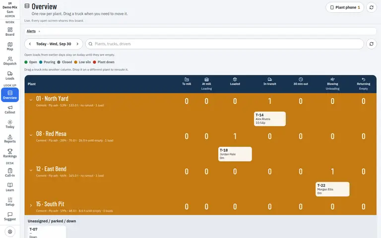
- 1. One row per plant
Who uses it
- Dispatcher
- Manager
Works on
- Phone
- iPad
- Desktop
Questions
Is this live GPS tracking?
No. Positions are estimated from statuses and typical drive times between mills and plants. The map does not follow a puck in the cab.
Can GPS be hooked up later?
That is on the roadmap. Until then the map stays an estimate, and the status stays what a person marked.
What do the trucks look like?
A long-nose conventional tractor and tank, drawn to the road. Not a dot.